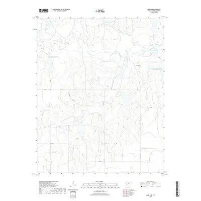
2019 Map of Lake June
USGS Topo · Published 2019About this map
Washita River and its various tributaries define the landscape of this Hemphill County quadrant, where the Dry Fork Washita River and Gageby Cr carve through the Texas Panhandle terrain. The area's water management is heavily influenced by the Soil Conservation Service, evidenced by several strategically placed impoundments like the Soil Conservation Service Site 14a Reservoir and Soil Conservation Service Site 28 Reservoir. These reservoirs, along with small bodies of water such as Lake June and Lake Cindy, provide essential catchment in an arid region historically prone to erosion. Local history is anchored by sites such as Elam Cemetery and Cataline Cem, while the inclusion of Jeff Puryear suggests specific land ownership or localized landmarks. The map also traces a network of farm-to-market roads, including FM 277 and FM 3303, which connect the rural properties and cattle ranching interests characteristic of the region.
Find a feature on this map
26 named features on this map. Tap any name to fly to it.
Don’t see what you’re looking for? This feature index may not catch every label — zoom into the map to look around manually.
Map Details
Editions of this 2019 Lake June Map
This is the sole edition of this map. No revisions or reprints were ever made.
Other maps of this area

1954 · Amarillo
USGS Topo · 1:250,000

1958 · Amarillo
USGS Topo · 1:250,000

1963 · Allison
USGS Topo · 1:24,000

1963 · Briscoe
USGS Topo · 1:24,000

1963 · Allison SW
USGS Topo · 1:24,000

1967 · Dads Creek
USGS Topo · 1:24,000

1967 · Gem
USGS Topo · 1:24,000

1967 · Hackberry Creek
USGS Topo · 1:24,000

1967 · Lake June
USGS Topo · 1:24,000

1967 · Blue Ridge School
USGS Topo · 1:24,000