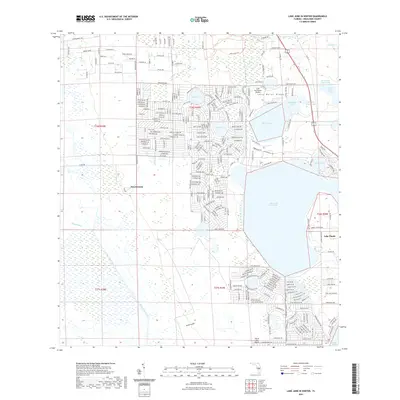
2021 Map of Lake June In Winter
USGS Topo · Published 2021About this map
The Lake Wales Ridge defines the high ground of this landscape, creating a distinct topographical divide between the extensive citrus groves and residential developments around Lake Placid and the marshy lowlands to the west. Central to this area is the massive expanse of Lake June in Winter, surrounded by smaller satellite waters like Lake Francis, Lake Carrie, and Lake Henry. The settlement patterns here reflect a mix of established town centers and rural pockets like Hen Scratch, all connected by a dense grid of residential streets with avian and botanical names. Local aviation is supported by the Placid Lakes Airport and the Lake Persimmon Airstrip, while the Csx Transportation line provides a heavy rail link through the eastern corridor. The hydrology is dominated by the westward flow of Fisheating Creek and Josephine Cr, which drain the sandy ridge into the surrounding Florida interior.
Find a feature on this map
199 named features on this map. Tap any name to fly to it.
Don’t see what you’re looking for? This feature index may not catch every label — zoom into the map to look around manually.
Map Details
Editions of this 2021 Lake June In Winter Map
This is the sole edition of this map. No revisions or reprints were ever made.
Other maps of this area

1952 · Lake Placid
USGS Topo · 1:24,000

1952 · Lorida
USGS Topo · 1:24,000

1952 · Sebring
USGS Topo · 1:24,000

1953 · Lake June In Winter
USGS Topo · 1:24,000

1953 · Venus NW
USGS Topo · 1:24,000

1953 · Crewsville SE
USGS Topo · 1:24,000

1953 · Crewsville
USGS Topo · 1:24,000

1953 · Childs
USGS Topo · 1:24,000

1956 · Fort Pierce
USGS Topo · 1:250,000

1957 · Long Island Marsh NE
USGS Topo · 1:24,000