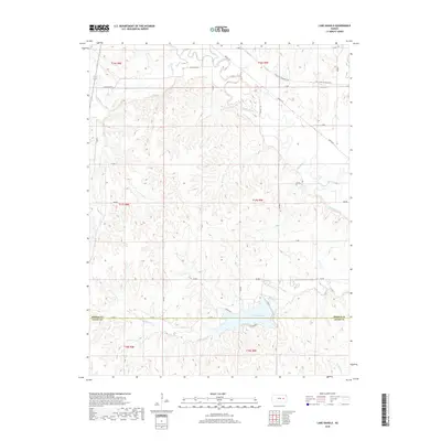
2018 Map of Lake Kahola
USGS Topo · Published 2018About this map
Lake Kahola and the winding course of the Neosho River dominate this rural landscape on the border of Morris and Chase counties. The area is defined by a dense network of watercourses, including Kahola Cr, Big John Cr, and Fourmile Cr, which carve through the terrain. The northern section of the map is traversed by the Flint Hills Nature Trail, following a former railroad corridor through the valley. This 2018 survey reveals a primarily agricultural region structured by a systematic grid of section roads like Dunlap Rd and Kahola Rd. The geography shows how modern recreational and conservation efforts, such as the trail and the lake, integrate with the long-standing creek-fed ranching and farming lands characteristic of the eastern Kansas plains.
Find a feature on this map
36 named features on this map. Tap any name to fly to it.
Don’t see what you’re looking for? This feature index may not catch every label — zoom into the map to look around manually.
Map Details
Editions of this 2018 Lake Kahola Map
This is the sole edition of this map. No revisions or reprints were ever made.
Other maps of this area

1885 · Eskridge
USGS Topo · 1:125,000

1888 · Emporia
USGS Topo · 1:125,000

1889 · Parkerville
USGS Topo · 1:125,000

1889 · Eskridge
USGS Topo · 1:125,000

1894 · Emporia
USGS Topo · 1:125,000

1894 · Eskridge
USGS Topo · 1:125,000

1894 · Parkerville
USGS Topo · 1:125,000

1898 · Cottonwood Falls
USGS Topo · 1:125,000

1955 · Hutchinson
USGS Topo · 1:250,000

1957 · Strong City
USGS Topo · 1:24,000