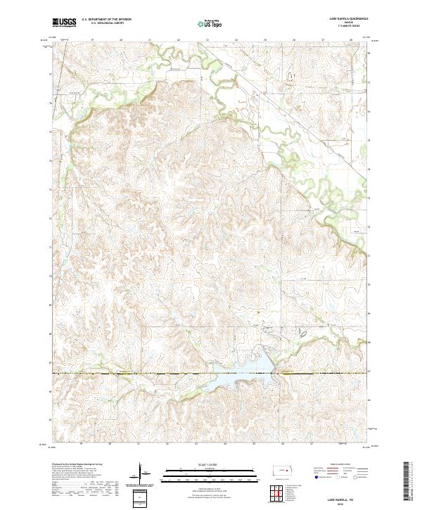
2022 Map of Lake Kahola
USGS Topo · Published 2022About this map
Lake Kahola anchors the southern landscape of this Morris County region, straddling the boundary between Morris Co and Chase Co. The surrounding terrain is defined by a dense network of watercourses, including the Neosho River and its various tributaries like Walker Br and Rock Cr. This area of the Flint Hills shows a clear section-line road grid, where routes such as Dunlap Rd and Kahola Rd provide access to the rural uplands between the creek valleys. The drainage pattern of Kahola Cr and Indian Cr illustrates the complex topography of the Kansas prairie, punctuated by the localized elevation changes typical of this watershed. The map records the contemporary footprint of recreational development and agricultural land use around the reservoir and along the river bottomlands.
Find a feature on this map
38 named features on this map. Tap any name to fly to it.
Don’t see what you’re looking for? This feature index may not catch every label — zoom into the map to look around manually.
Map Details
Editions of this 2022 Lake Kahola Map
This is the sole edition of this map. No revisions or reprints were ever made.
Other maps of this area

1885 · Eskridge
USGS Topo · 1:125,000

1888 · Emporia
USGS Topo · 1:125,000

1889 · Parkerville
USGS Topo · 1:125,000

1889 · Eskridge
USGS Topo · 1:125,000

1894 · Emporia
USGS Topo · 1:125,000

1894 · Eskridge
USGS Topo · 1:125,000

1894 · Parkerville
USGS Topo · 1:125,000

1898 · Cottonwood Falls
USGS Topo · 1:125,000

1955 · Hutchinson
USGS Topo · 1:250,000

1957 · Strong City
USGS Topo · 1:24,000