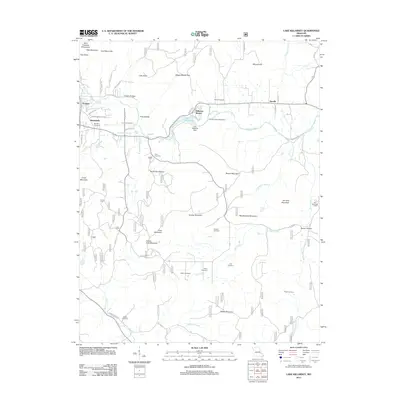
2011 Map of Lake Killarney
USGS Topo · Published 2011About this map
The Saint Francois Mountains dominate the landscape of Iron County, providing a high-relief backdrop for small settlements and rural homesteads. At the center of this terrain, Lake Killarney and the Lake Killarney Dam manage the waters of Stouts Creek as it flows toward the community of Roselle. The map is particularly dense with genealogical markers, including the Arcadia Valley Cemetery and several family-named burial sites such as Russell Cemetery, Cove Cemetery, and the Rebel Cemetery. From the western edge near Ironton and Russellville to the recreation areas at Arcadia Valley Bible Camp and Blue Mountain Camp, the topography is defined by prominent peaks like Pilot Knob, Grassy Mountain, and Tims Mountain. Numerous creek systems, including Rock Creek and Marble Creek, carve deep hollows through the timbered uplands.
Find a feature on this map
68 named features on this map. Tap any name to fly to it.
Don’t see what you’re looking for? This feature index may not catch every label — zoom into the map to look around manually.
Map Details
Editions of this 2011 Lake Killarney Map
This is the sole edition of this map. No revisions or reprints were ever made.
Other maps of this area

1926 · Des Arc
USGS Topo · 1:62,500

1929 · Des Arc
USGS Topo · 1:62,500

1930 · Coldwater
USGS Topo · 1:62,500

1937 · Ironton
USGS Topo · 1:48,000

1939 · Fredericktown
USGS Topo · 1:48,000

1945 · Ironton
USGS Topo · 1:62,500

1946 · Ironton
USGS Topo · 1:62,500

1947 · Fredericktown
USGS Topo · 1:62,500

1949 · Rolla
USGS Topo · 1:250,000

1949 · Coldwater
USGS Topo · 1:62,500