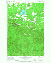
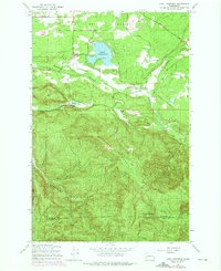
1959 Map of Lake Lawrence
USGS Topo · Published 1966About this map
Smith Prairie dominates the northern landscape of this mid-century survey, centered on the recreational and agricultural corridor surrounding Lake Lawrence. The map documents a transition from the level prairie settlements of Algyer, Mitchell, and Boudreau into the steep, timbered ridges of the southern interior. The industrial imprint of the timber industry is evident through the network of the Logging Railroad and the Old Railroad Grade snaking through the hills near Porcupine Ridge.
Find a feature on this map
39 named features on this map. Tap any name to fly to it.
Don’t see what you’re looking for? This feature index may not catch every label — zoom into the map to look around manually.
Map Details
Editions of this 1959 Lake Lawrence Map
2 editions found
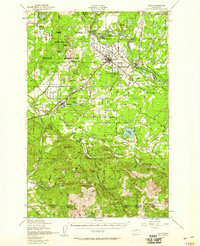
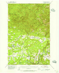
Other maps of this area

1916 · Chehalis
USGS Topo · 1:125,000

1937 · Eatonville
USGS Topo · 1:125,000

1941 · Tanwax Lake
USGS Topo · 1:62,500

1943 · Willapa
USGS Topo · 1:62,500

1944 · Yelm
USGS Topo · 1:62,500

1944 · Ohop Valley
USGS Topo · 1:62,500

1949 · Ohop Valley
USGS Topo · 1:62,500
1949 · Yelm
USGS Topo · 1:62,500

1953 · Hoquiam
USGS Topo · 1:250,000
1954 · Onalaska
USGS Topo · 1:62,500