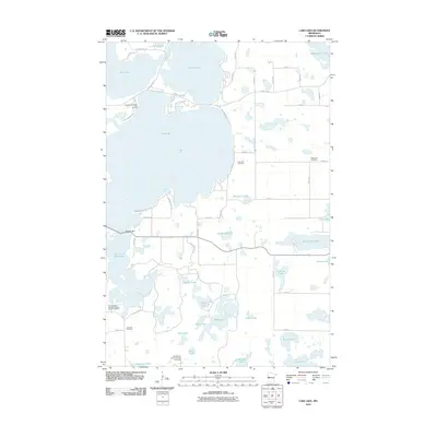
2010 Map of Lake Lida
USGS Topo · Published 2010About this map
Glacial lakes and small-scale recreation define this portion of Otter Tail County, dominated by the sprawling waters of Lake Lida and its South Arm. By the early 21st century, the shoreline had become a mixture of permanent residences and seasonal getaways, exemplified by the Crystal Lida Resort and RV Park and various developments accessed via Inlet Beach Rd and Lida Shores Loop. The landscape is dotted with smaller water bodies like Cataract Lake, Beiningen Lake, and Femling Lake, many of which are surrounded by a grid of township roads.
Find a feature on this map
60 named features on this map. Tap any name to fly to it.
Don’t see what you’re looking for? This feature index may not catch every label — zoom into the map to look around manually.
Map Details
Editions of this 2010 Lake Lida Map
This is the sole edition of this map. No revisions or reprints were ever made.
Other maps of this area

1912 · Vergas
USGS Topo · 1:62,500

1913 · Fergus Falls
USGS Topo · 1:62,500

1914 · Pelican Rapids
USGS Topo · 1:62,500

1915 · Underwood
USGS Topo · 1:62,500

1915 · Vergas
USGS Topo · 1:62,500

1917 · Pelican Rapids
USGS Topo · 1:62,500

1953 · Fargo
USGS Topo · 1:250,000

1953 · Brainerd
USGS Topo · 1:250,000

1956 · Fargo
USGS Topo · 1:250,000

1957 · Brainerd
USGS Topo · 1:250,000