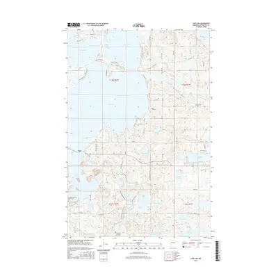
2016 Map of Lake Lida
USGS Topo · Published 2016About this map
Lake Lida dominates this landscape in central Minnesota, surrounded by a dense network of smaller water bodies including Crystal Lake, Lake Lizzie, and Beiningen Lake. The map reveals a high concentration of cemeteries and churches that speak to the long-established local communities, such as the Scandinavian Christian Mission Church Cem and the Maplewood Lutheran Church Cem. The terrain is characterized by intricate shorelines and points like Stoney Bar, with recreational and residential access provided by local routes like Lida Shore Loop and Inlet Beach Rd. Of particular interest to hikers and historians is the route of the N Country National Scenic Trail, which winds through the southern portion of the quadrangle past Grass Lake and Bass Lake, illustrating the integration of wilderness conservation within this lake-district environment.
Find a feature on this map
70 named features on this map. Tap any name to fly to it.
Don’t see what you’re looking for? This feature index may not catch every label — zoom into the map to look around manually.
Map Details
Editions of this 2016 Lake Lida Map
This is the sole edition of this map. No revisions or reprints were ever made.
Other maps of this area

1912 · Vergas
USGS Topo · 1:62,500

1913 · Fergus Falls
USGS Topo · 1:62,500

1914 · Pelican Rapids
USGS Topo · 1:62,500

1915 · Underwood
USGS Topo · 1:62,500

1915 · Vergas
USGS Topo · 1:62,500

1917 · Pelican Rapids
USGS Topo · 1:62,500

1953 · Fargo
USGS Topo · 1:250,000

1953 · Brainerd
USGS Topo · 1:250,000

1956 · Fargo
USGS Topo · 1:250,000

1957 · Brainerd
USGS Topo · 1:250,000