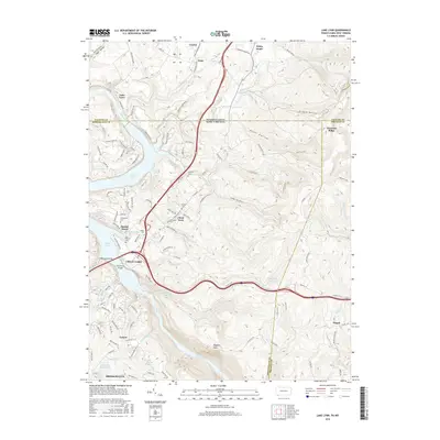
2016 Map of Lake Lynn
USGS Topo · Published 2016About this map
Cheat Lake dominates this 2016 landscape, spanning the border where southwestern Pennsylvania meets northern West Virginia. This modern survey captures the complex residential and recreational development along the impounded Cheat River, featuring named areas like Sunset Beach and Cheat Neck. For the family historian, the map preserves the locations of numerous small burial grounds, including the Jennewine Cem and Coles Run Cem, which sit alongside established institutions like Zion Church.
Find a feature on this map
134 named features on this map. Tap any name to fly to it.
Don’t see what you’re looking for? This feature index may not catch every label — zoom into the map to look around manually.
Map Details
Editions of this 2016 Lake Lynn Map
This is the sole edition of this map. No revisions or reprints were ever made.
Other maps of this area

1900 · Uniontown
USGS Topo · 1:62,500

1900 · Masontown
USGS Topo · 1:62,500

1902 · Morgantown
USGS Topo · 1:62,500

1903 · Masontown
USGS Topo · 1:62,500

1904 · Bruceton
USGS Topo · 1:62,500

1925 · Morgantown
USGS Topo · 1:62,500

1926 · Bruceton
USGS Topo · 1:62,500

1931 · Uniontown
USGS Topo · 1:62,500

1931 · Masontown
USGS Topo · 1:62,500

1931 · Bruceton Mills
USGS Topo · 1:62,500