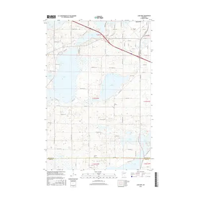
2016 Map of Lake Mary
USGS Topo · Published 2016About this map
The glacial lakes and wetlands of central Minnesota define this landscape south of Alexandria, where the water-rich terrain of the Douglas Co and Pope Co border area is documented in high detail. Significant water bodies like Lake Mary, Lake Latoka, and Lake Andrew dominate the topography, interspersed with smaller features such as Skogland Slough and Turtle Lake. The map reveals a transition from the developing southern fringes of Alexandria, marked by Chandler Field, to more rural cemetery sites and family road names. Researchers can identify Evergreen Cem, Lake Mary Cem, and Bohemian Cem, providing essential points for genealogical study. The network of local roads, including Town Hall Rd SW and Magnuson Rd SW, illustrates the rural settlement patterns and accessibility of the lakefronts during the mid-2010s.
Find a feature on this map
91 named features on this map. Tap any name to fly to it.
Don’t see what you’re looking for? This feature index may not catch every label — zoom into the map to look around manually.
Map Details
Editions of this 2016 Lake Mary Map
This is the sole edition of this map. No revisions or reprints were ever made.
Other maps of this area

1953 · Saint Cloud
USGS Topo · 1:250,000

1957 · Saint Cloud
USGS Topo · 1:250,000

1958 · Saint Cloud
USGS Topo · 1:250,000

1966 · Brandon
USGS Topo · 1:24,000

1966 · Alexandria West
USGS Topo · 1:24,000

1966 · Farwell
USGS Topo · 1:24,000

1966 · Lake Mary
USGS Topo · 1:24,000

1966 · Alexandria East
USGS Topo · 1:24,000

1966 · Forada
USGS Topo · 1:24,000

1968 · Lowry
USGS Topo · 1:24,000