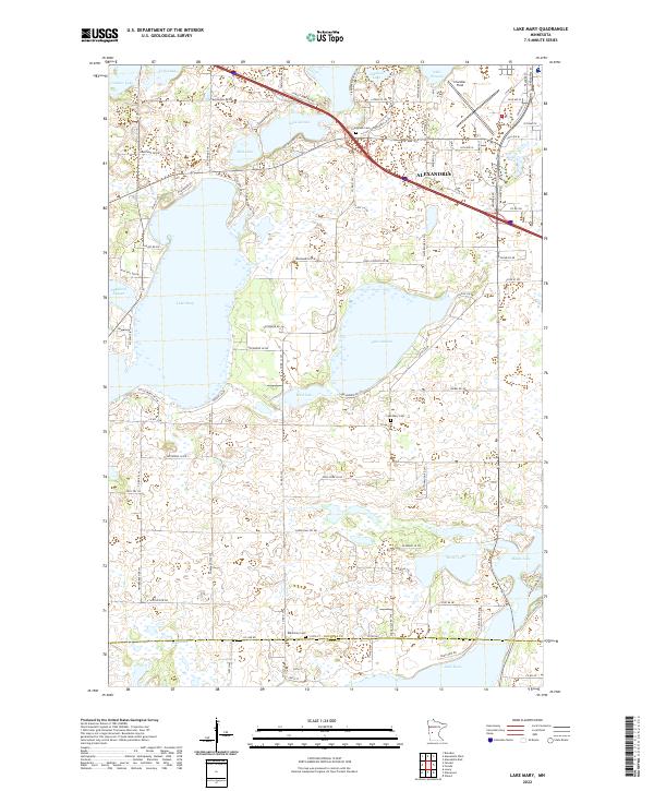
2022 Map of Lake Mary
USGS Topo · Published 2022About this map
The southwest outskirts of Alexandria anchor this detailed study of the glaciated landscape in Douglas County. The area is defined by a dense network of lakes, from the expansive Lake Mary and Lake Andrew to smaller bodies like Lake Latoka, Lake Winona, and Johnson Lake. This environment shaped the local settlement patterns, with roads like Firemens Lodge Rd SW and Vonderheide Dr SW navigating between water bodies and wetlands such as Skogland Slough. For those tracing local roots, the map provides precise locations for three distinct burial grounds: Evergreen Cem near the city, the more central Lake Mary Cem, and the Bohemian Cem located further south near the Pope County line. Modern infrastructure, including Chandler Field and the commercial corridor along S Broadway St, contrasts with the older township boundaries of t127n r38w and surrounding sections.
Find a feature on this map
102 named features on this map. Tap any name to fly to it.
Don’t see what you’re looking for? This feature index may not catch every label — zoom into the map to look around manually.
Map Details
Editions of this 2022 Lake Mary Map
This is the sole edition of this map. No revisions or reprints were ever made.
Other maps of this area

1953 · Saint Cloud
USGS Topo · 1:250,000

1957 · Saint Cloud
USGS Topo · 1:250,000

1958 · Saint Cloud
USGS Topo · 1:250,000

1966 · Brandon
USGS Topo · 1:24,000

1966 · Alexandria West
USGS Topo · 1:24,000

1966 · Farwell
USGS Topo · 1:24,000

1966 · Lake Mary
USGS Topo · 1:24,000

1966 · Alexandria East
USGS Topo · 1:24,000

1966 · Forada
USGS Topo · 1:24,000

1968 · Lowry
USGS Topo · 1:24,000