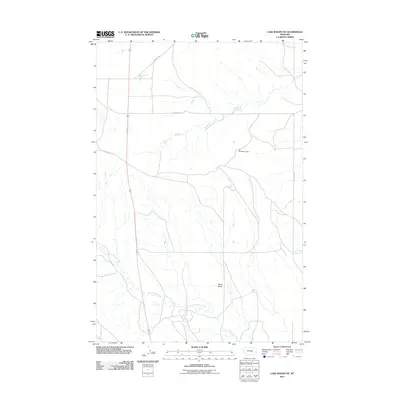
2011 Map of Lake Mason NE
USGS Topo · Published 2011About this map
Devils Basin sits at the heart of this central Montana landscape, where the seasonal waters of North Willow Creek and Crooked Creek carve paths through the arid terrain. The map documents a sparsely populated ranching and grazing region in Petroleum County as it appeared in the early 21st century. The sparse road network, including Winnett Rd and Alec Roy Rd, reflects a landscape defined by large landholdings and significant distances between improvements. Small-scale water management is evident at the Ivy Number 3 Dam, a common feature in this part of the state where capturing runoff from drainages like Little Wall Creek is essential for livestock. This survey provides a clear look at the topographic character and drainage patterns of the northern plains, illustrating how geographic features and ranch roads dictate the layout of this remote territory.
Find a feature on this map
8 named features on this map. Tap any name to fly to it.
Don’t see what you’re looking for? This feature index may not catch every label — zoom into the map to look around manually.
Map Details
Editions of this 2011 Lake Mason NE Map
This is the sole edition of this map. No revisions or reprints were ever made.
Other maps of this area

1954 · Roundup
USGS Topo · 1:250,000

1958 · Roundup
USGS Topo · 1:250,000

1986 · Lake Mason SE
USGS Topo · 1:24,000

1986 · Pike Creek Hills West
USGS Topo · 1:24,000

1986 · Lake Mason NE
USGS Topo · 1:24,000

1986 · Lake Mason NW
USGS Topo · 1:24,000

1986 · Flatwillow
USGS Topo · 1:24,000

1986 · Pike Creek Hills East
USGS Topo · 1:24,000

1986 · Big Wall West
USGS Topo · 1:24,000

1986 · Big Wall NW
USGS Topo · 1:24,000