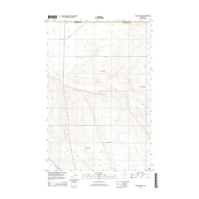
2014 Map of Lake Mason NE
USGS Topo · Published 2014About this map
Devils Basin dominates the southern portion of this landscape at the boundary of Petroleum and Musselshell counties. This central Montana rangeland is defined by a sparse but deliberate network of local roads and watercourses that reflect the region's ranching heritage. Vital water sources like N Willow Cr, Crooked Cr, and Little Wall Cr thread through the township sections, providing the necessary infrastructure for livestock in an arid environment. The road system, including Shipp Rd, Colony Rd, and Alec Roy Rd, follows the section lines and natural contours of the basin, connecting isolated homesteads to the primary north-south artery of Us-87 and the spur of MT-244. This 2014 survey documents the enduring spatial arrangement of a Montana cattle-country landscape where family names are often preserved in the names of the very roads that traverse the basin.
Find a feature on this map
14 named features on this map. Tap any name to fly to it.
Don’t see what you’re looking for? This feature index may not catch every label — zoom into the map to look around manually.
Map Details
Editions of this 2014 Lake Mason NE Map
This is the sole edition of this map. No revisions or reprints were ever made.
Other maps of this area

1954 · Roundup
USGS Topo · 1:250,000

1958 · Roundup
USGS Topo · 1:250,000

1986 · Lake Mason SE
USGS Topo · 1:24,000

1986 · Pike Creek Hills West
USGS Topo · 1:24,000

1986 · Lake Mason NE
USGS Topo · 1:24,000

1986 · Lake Mason NW
USGS Topo · 1:24,000

1986 · Flatwillow
USGS Topo · 1:24,000

1986 · Pike Creek Hills East
USGS Topo · 1:24,000

1986 · Big Wall West
USGS Topo · 1:24,000

1986 · Big Wall NW
USGS Topo · 1:24,000