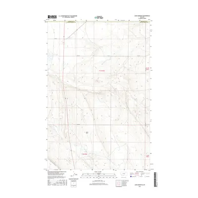
2017 Map of Lake Mason NE
USGS Topo · Published 2017About this map
Devils Basin serves as the central topographic focus of this Petroleum County landscape, where the high plains of central Montana meet the intricate drainage patterns of the Missouri River watershed. This modern 2017 survey shows a region defined by its vast open stretches and rural connectivity, with a network of local thoroughfares such as Shipp Rd, Colony Rd, and Alec Roy Rd providing access across the township lines. The natural geography is dictated by the courses of N Willow Cr and Crooked Cr, which carve through the terrain as they flow toward the north and east. The map provides a clear look at the jurisdictional boundaries between Petroleum and Musselshell counties, illustrating the sparsely populated ranching and grazing land that characterizes this portion of the state in the early 21st century.
Find a feature on this map
13 named features on this map. Tap any name to fly to it.
Don’t see what you’re looking for? This feature index may not catch every label — zoom into the map to look around manually.
Map Details
Editions of this 2017 Lake Mason NE Map
This is the sole edition of this map. No revisions or reprints were ever made.
Other maps of this area

1954 · Roundup
USGS Topo · 1:250,000

1958 · Roundup
USGS Topo · 1:250,000

1986 · Lake Mason SE
USGS Topo · 1:24,000

1986 · Pike Creek Hills West
USGS Topo · 1:24,000

1986 · Lake Mason NE
USGS Topo · 1:24,000

1986 · Lake Mason NW
USGS Topo · 1:24,000

1986 · Flatwillow
USGS Topo · 1:24,000

1986 · Pike Creek Hills East
USGS Topo · 1:24,000

1986 · Big Wall West
USGS Topo · 1:24,000

1986 · Big Wall NW
USGS Topo · 1:24,000