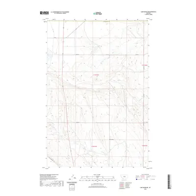
2020 Map of Lake Mason NE
USGS Topo · Published 2020About this map
Devils Basin dominates the lower central portion of this landscape in Petroleum County, where the terrain transitions into the high plains of central Montana. The drainage patterns of N Willow Cr and Crooked Cr define the local topography, carving across the sections and townships of this ranching country. Sparse infrastructure connects the various landholdings, primarily through a network of local roads such as Colony Rd and Shipp Rd. To the south, Snowy Mountain Rd skirts the rising elevations, while the boundary with Musselshell Co marks the northern limit of the survey. The map provides a clear look at the late twentieth-century land management grid, showing the precise alignment of range and township lines across this open territory.
Find a feature on this map
13 named features on this map. Tap any name to fly to it.
Don’t see what you’re looking for? This feature index may not catch every label — zoom into the map to look around manually.
Map Details
Editions of this 2020 Lake Mason NE Map
This is the sole edition of this map. No revisions or reprints were ever made.
Other maps of this area

1954 · Roundup
USGS Topo · 1:250,000

1958 · Roundup
USGS Topo · 1:250,000

1986 · Lake Mason SE
USGS Topo · 1:24,000

1986 · Pike Creek Hills West
USGS Topo · 1:24,000

1986 · Lake Mason NE
USGS Topo · 1:24,000

1986 · Lake Mason NW
USGS Topo · 1:24,000

1986 · Flatwillow
USGS Topo · 1:24,000

1986 · Pike Creek Hills East
USGS Topo · 1:24,000

1986 · Big Wall West
USGS Topo · 1:24,000

1986 · Big Wall NW
USGS Topo · 1:24,000