
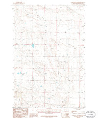
1986 Map of Lake Mason NW
USGS Topo · Published 1986About this map
Lake Mason National Wildlife Refuge anchors the southern reaches of this landscape, where the prairie begins to break into the complex drainages of the Missouri River watershed. The terrain is defined by the sweeping contours of the Devils Basin, a prominent geological depression that dominates the eastern half of the survey. This 1986 record captures the industrial footprint of the era, marked by a concentrated cluster of Oil Wells situated within the basin's boundaries.
Find a feature on this map
9 named features on this map. Tap any name to fly to it.
Don’t see what you’re looking for? This feature index may not catch every label — zoom into the map to look around manually.
Map Details
Editions of this 1986 Lake Mason NW Map
This is the sole edition of this map. No revisions or reprints were ever made.
Other maps of this area

1954 · Roundup
USGS Topo · 1:250,000

1958 · Roundup
USGS Topo · 1:250,000

1986 · Tyler
USGS Topo · 1:24,000

1986 · Lake Mason SE
USGS Topo · 1:24,000

1986 · Pender Coulee
USGS Topo · 1:24,000

1986 · Pike Creek Hills West
USGS Topo · 1:24,000

1986 · Lake Mason NE
USGS Topo · 1:24,000

1986 · Pike Creek Hills East
USGS Topo · 1:24,000
1986 · Timber Buttes North
USGS Topo · 1:24,000
1986 · Lake Mason
USGS Topo · 1:24,000