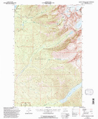
1994 Map of Lake Mc Donald East
USGS Topo · Published 1997About this map
Sperry Chalets stands as a landmark of high-altitude hospitality within the heart of Glacier National Park, serving as a focal point for the early 1990s backcountry infrastructure. This area is defined by its dramatic verticality, where the Sperry Glacier feeds a complex network of alpine water bodies including Feather Woman Lake and Akaiyan Lake. The map reveals the intricate drainage patterns of Snyder Creek and Sprague Creek as they flow toward the eastern shore of Lake McDonald.
Find a feature on this map
41 named features on this map. Tap any name to fly to it.
Don’t see what you’re looking for? This feature index may not catch every label — zoom into the map to look around manually.
Map Details
Editions of this 1994 Lake Mc Donald East Map
This is the sole edition of this map. No revisions or reprints were ever made.
Other maps of this area

1904 · Chief Mountain
USGS Topo · 1:125,000

1914 · Nyack
USGS Topo · 1:125,000

1938 · Chief Mountain
USGS Topo · 1:125,000

1960 · Cut Bank
USGS Topo · 1:250,000

1963 · Cut Bank
USGS Topo · 1:250,000

1964 · Cut Bank
USGS Topo · 1:250,000

1964 · Nyack
USGS Topo · 1:24,000

1964 · Stanton Lake
USGS Topo · 1:24,000
1964 · West Glacier
USGS Topo · 1:24,000
1968 · Lake Mc Donald West
USGS Topo · 1:24,000