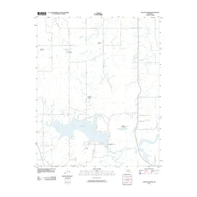
2010 Map of Lake McAlester
USGS Topo · Published 2010About this map
Lake McAlester serves as the dominant hydrological feature of this Oklahoma landscape, surrounded by a network of rural roads and water management structures. The reservoir, contained by the Lake McAlester Dam, is fed by several water bodies including Bull Creek and Wildhorse Creek. To the north, the terrain rises toward the summit of Bald Mountain, while the southwestern corner of the quadrangle transitions into the open expanse of Tannehill Prairie.
Find a feature on this map
52 named features on this map. Tap any name to fly to it.
Don’t see what you’re looking for? This feature index may not catch every label — zoom into the map to look around manually.
Map Details
Editions of this 2010 Lake McAlester Map
This is the sole edition of this map. No revisions or reprints were ever made.
Other maps of this area

1898 · McAlester
USGS Topo · 1:125,000

1900 · Canadian
USGS Topo · 1:125,000

1909 · Mc Alester
USGS Topo · 1:125,000

1946 · Fort Smith
USGS Topo · 1:250,000

1950 · Mcalester
USGS Topo · 1:250,000

1962 · McAlester
USGS Topo · 1:250,000

1965 · Fort Smith
USGS Topo · 1:250,000

1965 · McAlester
USGS Topo · 1:250,000
1966 · Haywood
USGS Topo · 1:24,000

1967 · Fort Smith
USGS Topo · 1:250,000