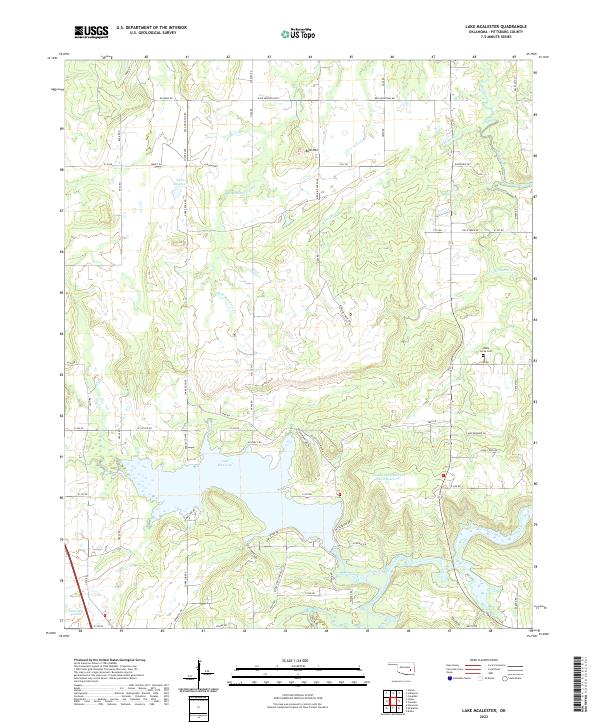
2022 Map of Lake McAlester
USGS Topo · Published 2022About this map
Lake McAlester serves as the central focal point of this Oklahoma landscape, its northern reaches defined by the irregular fingers of its shoreline. To the southwest, the Tannehill Prairie marks a transition in the terrain, while the northern section is dominated by the prominence of Bald Mtn. The drainage network across this region is dense, with Bald Mountain Cr, Medicine Cr, and Rock Creek carving through the Pittsburg County hills. Local history is anchored by the Shady Grove Cem located in the eastern portion of the quadrangle. The map details a rural infrastructure of named section line roads and smaller water management projects like the Caston Mountain Cr Site 4 Reservoir, illustrating how the landscape has been shaped for utility and local industry in recent decades.
Find a feature on this map
75 named features on this map. Tap any name to fly to it.
Don’t see what you’re looking for? This feature index may not catch every label — zoom into the map to look around manually.
Map Details
Editions of this 2022 Lake McAlester Map
This is the sole edition of this map. No revisions or reprints were ever made.
Other maps of this area

1898 · McAlester
USGS Topo · 1:125,000

1900 · Canadian
USGS Topo · 1:125,000

1909 · Mc Alester
USGS Topo · 1:125,000

1946 · Fort Smith
USGS Topo · 1:250,000

1950 · Mcalester
USGS Topo · 1:250,000

1962 · McAlester
USGS Topo · 1:250,000

1965 · Fort Smith
USGS Topo · 1:250,000

1965 · McAlester
USGS Topo · 1:250,000
1966 · Haywood
USGS Topo · 1:24,000

1967 · Fort Smith
USGS Topo · 1:250,000