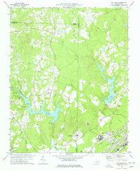
1977 Map of Lake Michie
USGS Topo · Published 1977About this map
Lake Michie dominates this landscape along the Flat River, serving as a central geographic feature in the late 1970s. The surrounding terrain is a mix of small settlements and institutional land use, with the community of Bahama situated near the western shores and Butner to the southeast. The area around Butner is particularly developed, featuring the State Hospital, a Filtration Plant, and an Armory served by the Southern railroad line.
Find a feature on this map
37 named features on this map. Tap any name to fly to it.
Don’t see what you’re looking for? This feature index may not catch every label — zoom into the map to look around manually.
Map Details
Editions of this 1977 Lake Michie Map
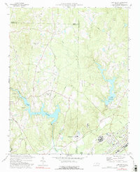
2 editions found
Other maps of this area

1943 · Roxboro
USGS Topo · 1:62,500

1943 · Creedmoor
USGS Topo · 1:62,500

1944 · Creedmoor
USGS Topo · 1:62,500

1951 · Durham North
USGS Topo · 1:62,500

1953 · Oxford
USGS Topo · 1:62,500

1953 · Greensboro
USGS Topo · 1:250,000

1954 · Greensboro
USGS Topo · 1:250,000

1962 · Greensboro
USGS Topo · 1:250,000

1966 · Greensboro
USGS Topo · 1:250,000

1966 · Oxford
USGS Topo · 1:62,500