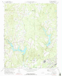
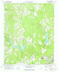
1977 Map of Lake Michie
USGS Topo · Published 1992About this map
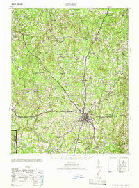
The Flat River and Lake Michie anchor this section of North Carolina's Piedmont, where the rural landscapes of Durham and Granville counties converge. The map documents the extensive institutional infrastructure near Butner, including the State Hospital, the Federal Center for Correctional Research, and a regional Filtration Plant. This mid-1970s landscape, photoinspected in the early 1990s, preserves the locations of numerous family and community landmarks such as Carrington Cem, Ellis Chapel, and the Dillon Sch. Transportation networks are clearly defined by the Norfolk and Western and Southern railroads, which served the small communities of Bahama and Willardville. Beyond the developed corridors, the terrain is defined by a dense network of tributaries including Knap Creek, Dial Creek, and Rocky Creek, alongside recreation sites like Spruce Pine Campground and Holly Grove Campground.
Find a feature on this map
41 named features on this map. Tap any name to fly to it.
Don’t see what you’re looking for? This feature index may not catch every label — zoom into the map to look around manually.
Map Details
Editions of this 1977 Lake Michie Map
2 editions found
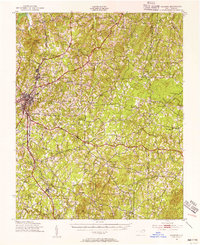
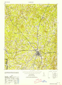
Other maps of this area
1943 · Roxboro
USGS Topo · 1:62,500

1943 · Creedmoor
USGS Topo · 1:62,500

1944 · Creedmoor
USGS Topo · 1:62,500

1951 · Durham North
USGS Topo · 1:62,500
1953 · Oxford
USGS Topo · 1:62,500

1953 · Greensboro
USGS Topo · 1:250,000

1954 · Greensboro
USGS Topo · 1:250,000

1962 · Greensboro
USGS Topo · 1:250,000

1966 · Greensboro
USGS Topo · 1:250,000
1966 · Oxford
USGS Topo · 1:62,500