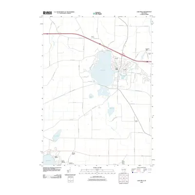
2010 Map of Lake Mills
USGS Topo · Published 2010About this map
Rock Lake serves as the central focal point for this section of Jefferson County, anchoring the community of Lake Mills. The town's layout reflects a mix of lakeside residential growth and traditional commercial infrastructure, including the Lake Mills Post Office. To the north, the industrial legacy of the area is noted by Hoopers Mill and its associated Hoopers Dam along the drainage of Rock Creek.
Find a feature on this map
54 named features on this map. Tap any name to fly to it.
Don’t see what you’re looking for? This feature index may not catch every label — zoom into the map to look around manually.
Map Details
Editions of this 2010 Lake Mills Map
This is the sole edition of this map. No revisions or reprints were ever made.
Other maps of this area

1890 · Sun Prairie
USGS Topo · 1:62,500

1890 · Stoughton
USGS Topo · 1:62,500

1891 · Waterloo
USGS Topo · 1:62,500

1891 · Koshkonong
USGS Topo · 1:62,500

1894 · Waterloo
USGS Topo · 1:62,500

1894 · Koshkonong
USGS Topo · 1:62,500

1896 · Sun Prairie
USGS Topo · 1:62,500

1905 · Sun Prairie
USGS Topo · 1:62,500

1906 · Koshkonong
USGS Topo · 1:62,500

1907 · Sun Prairie
USGS Topo · 1:62,500