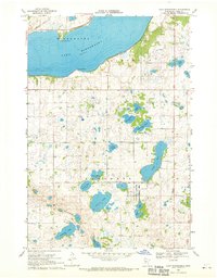
1968 Map of Lake Minnewaska
USGS Topo · Published 1970About this map
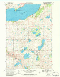
Lake Minnewaska dominates the northern landscape of this Pope County region, characterized by its deep waters and the prominent shoreline of Lawrence Point and Swenson Point. The terrain to the south reveals a glaciated prairie landscape dense with smaller water bodies like Nelson Lake, Lake Jennum, and Ben Lake. The Northern Pacific railroad cuts across the northwest corner, serving as a primary transit artery for the agricultural community. Cultural landmarks such as the Barsness Ch and the Townhall anchor the rural townships of Barsness and Glenwood. Along the southern ridges of the Blue Mounds, the presence of several Gravel Pits suggests the importance of local mineral extraction in the late 1960s, while the Pezhekee Golf Course and a National Wildlife Management Area reflect the area's dual role in recreation and conservation.
Find a feature on this map
28 named features on this map. Tap any name to fly to it.
Don’t see what you’re looking for? This feature index may not catch every label — zoom into the map to look around manually.
Map Details
Editions of this 1968 Lake Minnewaska Map
2 editions found
Other maps of this area

1953 · Saint Cloud
USGS Topo · 1:250,000

1957 · Saint Cloud
USGS Topo · 1:250,000

1958 · Saint Cloud
USGS Topo · 1:250,000

1968 · Starbuck
USGS Topo · 1:24,000

1968 · Lowry
USGS Topo · 1:24,000

1968 · Glenwood
USGS Topo · 1:24,000

1968 · Terrace
USGS Topo · 1:24,000
1968 · Villard
USGS Topo · 1:24,000

1968 · Lake Hassel
USGS Topo · 1:24,000

1968 · Lake Simon
USGS Topo · 1:24,000