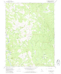
1967 Map of Lake Mountain
USGS Topo · Published 1985About this map
Six Rivers National Forest terrain dominates this 1967 survey of eastern Trinity County, defined by the winding course of the Eel River. The landscape reveals a pattern of mid-century ranching and remote settlement, centered around Hoaglin Valley and isolated outposts such as Jamison Ranch and Lampley Ranch. Significant elevation changes are marked by peaks like Pilot Peak and Moose Peak, while the lower elevations near the river show signs of industrial infrastructure, including a Tunnel and several Mines. The presence of the Lake Mountain Landing Strip and various corrals like Lone Pine Corrals and Pepperwood Corrals suggests an era when air travel and livestock management were critical for navigating this backcountry. Numerous seasonal lakes, such as Turtle Lake, Lost Lake, and Dry Lake, are scattered across the high ridges, providing vital water sources in the steep canyon country.
Find a feature on this map
40 named features on this map. Tap any name to fly to it.
Don’t see what you’re looking for? This feature index may not catch every label — zoom into the map to look around manually.
Map Details
Editions of this 1967 Lake Mountain Map
2 editions found
Other maps of this area

1920 · Cummings
USGS Topo · 1:62,500

1920 · Covelo
USGS Topo · 1:62,500

1920 · Harris
USGS Topo · 1:62,500

1921 · Hoaglin
USGS Topo · 1:62,500

1922 · Island Mountain
USGS Topo · 1:62,500

1931 · Hoaglin
USGS Topo · 1:96,000

1935 · Hoaglin
USGS Topo · 1:125,000

1949 · Alderpoint
USGS Topo · 1:62,500

1951 · Alderpoint
USGS Topo · 1:62,500

1952 · Spyrock
USGS Topo · 1:62,500