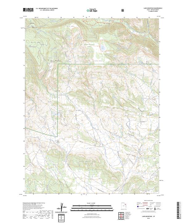
2023 Map of Lake Mountain
USGS Topo · Published 2023About this map
Ashley National Forest dominates this high-altitude landscape in the eastern Uinta Mountains, where a complex network of springs and canyons dictates the movement of water and travelers alike. The hydrography of the region is notably varied, featuring the subterranean drainage of Mosby Sink and the high-elevation Gull Lake. The names etched into the terrain, such as Uranium Spring and Prospector Spring, point to a history of mineral exploration and resource management. Settlement is sparse, represented primarily by the Deep Creek Ranch in the southeast. Transportation is largely defined by specialized routes like the Dry Fork Flume Trl and Paradise Park Rd, while the southern portion of the map transitions into the Little Water Hills, showing the dramatic elevation changes that characterize the Chalk Cliffs and Sawtooth Ridge.
Find a feature on this map
82 named features on this map. Tap any name to fly to it.
Don’t see what you’re looking for? This feature index may not catch every label — zoom into the map to look around manually.
Map Details
Editions of this 2023 Lake Mountain Map
This is the sole edition of this map. No revisions or reprints were ever made.
Other maps of this area

1885 · Ashley
USGS Topo · 1:250,000

1906 · Marsh Peak
USGS Topo · 1:125,000

1908 · Marsh Peak
USGS Topo · 1:125,000

1917 · Vernal
USGS Topo · 1:125,000

1954 · Vernal
USGS Topo · 1:250,000

1958 · Vernal
USGS Topo · 1:250,000

1960 · Vernal
USGS Topo · 1:250,000

1964 · Lapoint
USGS Topo · 1:24,000
1964 · Whiterocks
USGS Topo · 1:24,000
1964 · Vernal NW
USGS Topo · 1:24,000