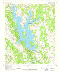
1964 Map of Lake Murray
USGS Topo · Published 1978About this map
Lake Murray State Park dominates this 1960s landscape, its sprawling waters bifurcated by long, finger-like peninsulas such as Tipps Point and Buzzard Roost. The reservoir, with its West Anadarche Arm and East Anadarche Arm, was already well-established as a recreational hub by this time, featuring several Youth Camps and the prominent Tucker Tower overlooking the water. In the southern reaches, the smaller Hickory Lake and the edges of Lake Texoma illustrate the extensive hydraulic engineering of the region.
Find a feature on this map
30 named features on this map. Tap any name to fly to it.
Don’t see what you’re looking for? This feature index may not catch every label — zoom into the map to look around manually.
Map Details
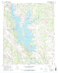
Editions of this 1964 Lake Murray Map
3 editions found

Other maps of this area

1901 · Tishomingo
USGS Topo · 1:125,000

1901 · Ardmore
USGS Topo · 1:125,000

1901 · Denison
USGS Topo · 1:125,000

1902 · Gainesville
USGS Topo · 1:125,000

1918 · Ardmore
USGS Topo · 1:125,000

1943 · Gainesville
USGS Topo · 1:125,000

1954 · Sherman
USGS Topo · 1:250,000

1957 · Ardmore
USGS Topo · 1:250,000

1958 · Gordonville
USGS Topo · 1:62,500

1958 · Sherman
USGS Topo · 1:250,000