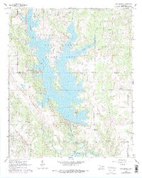
1964 Map of Lake Murray
USGS Topo · Published 1978About this map
Lake Murray State Park anchors this 1960s landscape, where the intricate shoreline of Lake Murray meets the rolling terrain of Southern Oklahoma. The map documents a transition between protected recreational lands and the surrounding rural infrastructure, featuring the notable Tucker Tower and a dedicated Landing Strip near the lake's western edge. South of the state park boundary, the land is marked by small family and community landmarks, including the Wilson Cem and Legate Cem, alongside the Bethel Union Ch. The southern margin reveals the northern reaches of Lake Texoma where Hickory Creek and Pumpkin Creek converge. Transportation in the region is defined by the Atchison Topeka and Santa Fe railroad corridor and local routes like Elephant Rock Road, illustrating the intersection of natural resources and 20th-century development in Love County.
Find a feature on this map
36 named features on this map. Tap any name to fly to it.
Don’t see what you’re looking for? This feature index may not catch every label — zoom into the map to look around manually.
Map Details
Editions of this 1964 Lake Murray Map
3 editions found

Other maps of this area

1901 · Tishomingo
USGS Topo · 1:125,000

1901 · Ardmore
USGS Topo · 1:125,000

1901 · Denison
USGS Topo · 1:125,000

1902 · Gainesville
USGS Topo · 1:125,000

1918 · Ardmore
USGS Topo · 1:125,000

1943 · Gainesville
USGS Topo · 1:125,000

1954 · Sherman
USGS Topo · 1:250,000

1957 · Ardmore
USGS Topo · 1:250,000

1958 · Gordonville
USGS Topo · 1:62,500

1958 · Sherman
USGS Topo · 1:250,000