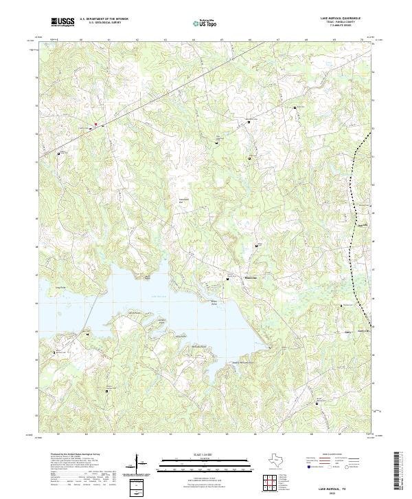
2022 Map of Lake Murvaul
USGS Topo · Published 2022About this map
Lake Murvaul dominates the central landscape of this Panola County survey, its irregular shoreline defined by numerous points and bays such as Lampin Point, Ritter Point, and Long Bay. The surrounding terrain is a network of small watercourses, including Murvaul Creek, Sixmile Cr, and Fallwell Cr, which feed into the primary reservoir. This area preserves a high density of small family and community burial grounds, serving as a primary resource for genealogical research in east Texas.
Find a feature on this map
110 named features on this map. Tap any name to fly to it.
Don’t see what you’re looking for? This feature index may not catch every label — zoom into the map to look around manually.
Map Details
Editions of this 2022 Lake Murvaul Map
This is the sole edition of this map. No revisions or reprints were ever made.
Other maps of this area

1953 · Palestine
USGS Topo · 1:250,000

1956 · Tyler
USGS Topo · 1:250,000

1957 · Palestine
USGS Topo · 1:250,000

1958 · Timpson
USGS Topo · 1:62,500

1958 · Carthage
USGS Topo · 1:62,500

1960 · Minden
USGS Topo · 1:62,500

1960 · Mount Enterprise
USGS Topo · 1:62,500

1983 · Long Branch
USGS Topo · 1:24,000

1983 · Fair Play
USGS Topo · 1:24,000
1983 · Gary
USGS Topo · 1:24,000