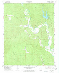
1974 Map of Lake Norrell
USGS Topo · Published 1977About this map
Lake Norrell and the winding North Fork Saline River define the character of this Saline County landscape in the mid-1970s. The terrain is deeply carved by drainage systems like Dog Creek and Moccasin Creek, with local landmarks like Devils Hollow and Stillhouse Hol suggesting a history of traditional rural life. The presence of a Landing Strip near the river indicates the area's utility for light aircraft, while the Spillway Elev 417 marks the engineered management of the reservoir.
Find a feature on this map
31 named features on this map. Tap any name to fly to it.
Don’t see what you’re looking for? This feature index may not catch every label — zoom into the map to look around manually.
Map Details
Editions of this 1974 Lake Norrell Map
3 editions found
Other maps of this area

1890 · Benton
USGS Topo · 1:125,000

1894 · Benton
USGS Topo · 1:125,000

1938 · Benton
USGS Topo · 1:48,000

1944 · Benton
USGS Topo · 1:62,500

1944 · Benton
USGS Topo · 1:31,680

1955 · Little Rock
USGS Topo · 1:250,000

1956 · Little Rock
USGS Topo · 1:250,000

1960 · Little Rock
USGS Topo · 1:250,000

1963 · Fourche SW
USGS Topo · 1:24,000

1963 · Paron
USGS Topo · 1:24,000