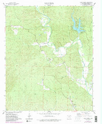
1974 Map of Lake Norrell
USGS Topo · Published 1984About this map
Lake Norrell and its Spillway anchor this section of Saline County, where the North Fork Saline River meanders through the central landscape. The 1974 topography illustrates a rural economy transitioning from traditional farming to recreational use, evidenced by the small Landing Strip near the river bend. Local history is deeply etched into the terrain through scattered places of worship and burial grounds, including Old Union Ch and its adjacent Old Union Cem, as well as Faith Ch further west. To the south, the settlement of Kentucky sits near the headwaters of Big Creek, while family-named landmarks like Langley Cem and Grape Chapel appear near Moccasin Creek. The map provides an intricate look at the hydrology of the area, featuring numerous named tributaries such as Turkey Creek, Brushy Cr, and Shockley Branch that feed into the larger river system.
Find a feature on this map
28 named features on this map. Tap any name to fly to it.
Don’t see what you’re looking for? This feature index may not catch every label — zoom into the map to look around manually.
Map Details
Editions of this 1974 Lake Norrell Map
3 editions found
Other maps of this area

1890 · Benton
USGS Topo · 1:125,000

1894 · Benton
USGS Topo · 1:125,000

1938 · Benton
USGS Topo · 1:48,000

1944 · Benton
USGS Topo · 1:62,500

1944 · Benton
USGS Topo · 1:31,680

1955 · Little Rock
USGS Topo · 1:250,000

1956 · Little Rock
USGS Topo · 1:250,000

1960 · Little Rock
USGS Topo · 1:250,000

1963 · Fourche SW
USGS Topo · 1:24,000

1963 · Paron
USGS Topo · 1:24,000