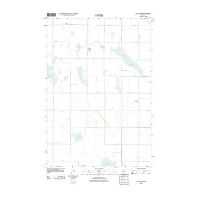
2010 Map of Lake Oliver
USGS Topo · Published 2010About this map
Lake Oliver and its surrounding prairie wetlands dominate this region of Big Stone County during the early 21st century. The landscape is defined by a dense grid of rural roads and scattered water bodies, including Large Henry Lake, Artichoke Lake, and Shible Lake. For those researching local family history, the map preserves the locations of several burial grounds that served the farming community, such as Waldum Cemetery in the north and Immanuel Cemetery to the east. The presence of Long Lake Cemetery near the now-drained or altered basins suggests the shifting nature of the local hydrography over decades of cultivation. Transport and access are tied to a network of county highways and section-line roads like County Hwy-27 and County Hwy-56, which connect the isolated farmsteads across this agricultural interior.
Find a feature on this map
34 named features on this map. Tap any name to fly to it.
Don’t see what you’re looking for? This feature index may not catch every label — zoom into the map to look around manually.
Map Details
Editions of this 2010 Lake Oliver Map
This is the sole edition of this map. No revisions or reprints were ever made.
Other maps of this area

1953 · Milbank
USGS Topo · 1:250,000

1953 · Saint Cloud
USGS Topo · 1:250,000

1957 · Saint Cloud
USGS Topo · 1:250,000

1958 · Milbank
USGS Topo · 1:250,000

1958 · Saint Cloud
USGS Topo · 1:250,000

1958 · Correll
USGS Topo · 1:24,000

1958 · Milan NW
USGS Topo · 1:24,000

1958 · Appleton
USGS Topo · 1:24,000

1968 · Dry Wood Lake
USGS Topo · 1:24,000

1968 · Lake Oliver
USGS Topo · 1:24,000