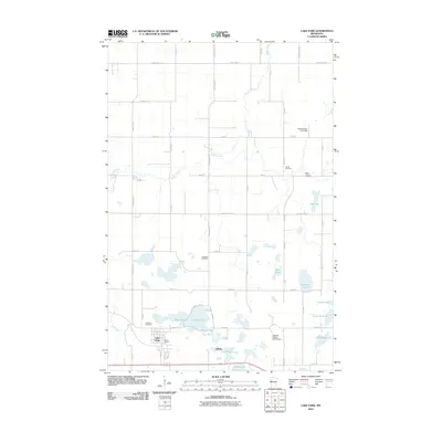
2010 Map of Lake Park
USGS Topo · Published 2010About this map
Lake Park serves as the primary hub in this Becker County landscape, where the prairie begins its transition into a region defined by glacial lakes and the winding Buffalo River. The map shows a clear pattern of rural development around smaller settlements like LaBelle and the seasonal residency at Tracy's RV Park. Genealogists will find significant value in the documentation of local burial grounds, including the Lake Park Cemetery, Saron Lutheran Cemetery, Larson Cemetery, and Baarstad Cemetery, which anchor the area's history. The water management and recreation of the early 21st century are evidenced by structures such as the Hamden Gun Club Dam and August Nelson Junior Dam. A high density of water bodies, from the larger Seabold Lake and Bay Lake to smaller basins like Little Boyer Lake, characterizes the local topography and drainage patterns near Hay Creek.
Find a feature on this map
48 named features on this map. Tap any name to fly to it.
Don’t see what you’re looking for? This feature index may not catch every label — zoom into the map to look around manually.
Map Details
Editions of this 2010 Lake Park Map
This is the sole edition of this map. No revisions or reprints were ever made.
Other maps of this area

1918 · Flom
USGS Topo · 1:62,500

1952 · Grand Forks
USGS Topo · 1:250,000

1953 · Fargo
USGS Topo · 1:250,000

1953 · Brainerd
USGS Topo · 1:250,000

1954 · Bemidji
USGS Topo · 1:250,000

1956 · Fargo
USGS Topo · 1:250,000

1956 · Grand Forks
USGS Topo · 1:250,000

1957 · Brainerd
USGS Topo · 1:250,000

1957 · Bemidji
USGS Topo · 1:250,000

1958 · Bemidji
USGS Topo · 1:250,000