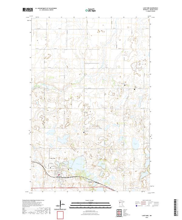
2022 Map of Lake Park
USGS Topo · Published 2022About this map
Lake Park serves as the primary hub in this Becker County landscape, where the prairie begins its transition into the lake-strewn glacial terrain of western Minnesota. The settlement of LaBelle sits just to the east, positioned near the shores of LaBelle Lake and the smaller Little Boyer Lake. The geography is defined by a dense network of water bodies and wetlands, including Seabold Lake, Bee Lake, and Larson Lake, which dot the eastern half of the quadrangle. The Buffalo River meanders through the northern sections, while Hay Cr drains the southwestern corner. For those tracing local heritage, the map is particularly rich in burial sites, documenting Oak Grove Cem, Lake Park Cem, and Baarstad Cem, along with the Saron Lutheran Cem and Larson Cem further north. This concentration of named cemeteries and the grid of county roads, such as Co RD 14 and Co RD 101, illustrate a long-established rural community built around small-town centers and agricultural sections.
Find a feature on this map
53 named features on this map. Tap any name to fly to it.
Don’t see what you’re looking for? This feature index may not catch every label — zoom into the map to look around manually.
Map Details
Editions of this 2022 Lake Park Map
This is the sole edition of this map. No revisions or reprints were ever made.
Other maps of this area

1918 · Flom
USGS Topo · 1:62,500

1952 · Grand Forks
USGS Topo · 1:250,000

1953 · Fargo
USGS Topo · 1:250,000

1953 · Brainerd
USGS Topo · 1:250,000

1954 · Bemidji
USGS Topo · 1:250,000

1956 · Fargo
USGS Topo · 1:250,000

1956 · Grand Forks
USGS Topo · 1:250,000

1957 · Brainerd
USGS Topo · 1:250,000

1957 · Bemidji
USGS Topo · 1:250,000

1958 · Bemidji
USGS Topo · 1:250,000