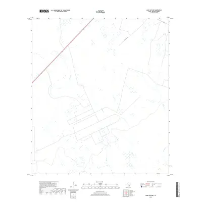
2019 Map of Lake Pasture
USGS Topo · Published 2019About this map
The coastal prairie of Refugio County is defined by a complex network of seasonal wetlands and slow-moving drainage systems, most notably Willow Cr and Salt Cr. This 2019 survey documents a landscape dominated by large agricultural tracts and ranching infrastructure, where the most prominent transit artery is the diagonal path of 77, cutting through the northwest corner toward the Gulf Coast. The presence of Artesian Cr on the eastern boundary and the winding Lake Pasture Rd suggests the continued importance of water management and rural access in this sparsely populated region. These topographic details reveal a territory shaped more by its hydrology and vast field patterns than by dense settlement, offering a clear view of modern land use in the Texas coastal plain.
Find a feature on this map
6 named features on this map. Tap any name to fly to it.
Don’t see what you’re looking for? This feature index may not catch every label — zoom into the map to look around manually.
Map Details
Editions of this 2019 Lake Pasture Map
This is the sole edition of this map. No revisions or reprints were ever made.
Other maps of this area

1952 · Tivoli
USGS Topo · 1:24,000

1952 · Bloomington SW
USGS Topo · 1:24,000

1952 · Tivoli SW
USGS Topo · 1:24,000

1953 · Beeville
USGS Topo · 1:250,000

1954 · Vidaurri
USGS Topo · 1:62,500

1956 · Beeville
USGS Topo · 1:250,000

1960 · Beeville
USGS Topo · 1:250,000

1962 · Lott Lake
USGS Topo · 1:24,000

1962 · McFaddin
USGS Topo · 1:24,000

1978 · Vidaurri
USGS Topo · 1:24,000