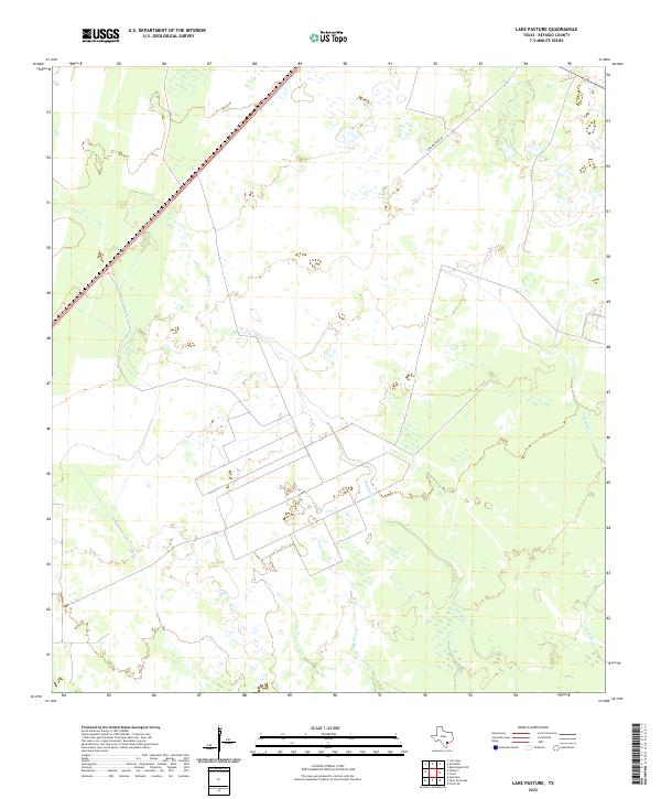
2022 Map of Lake Pasture
USGS Topo · Published 2022About this map
Low-lying coastal wetlands and a network of tidal drainage define this portion of Refugio County, as shown in this 2022 survey. The landscape is marked by the meandering paths of Willow Cr and Salt Cr, which cut through the marshy terrain toward the Gulf. Unlike more developed regions, this area remains dominated by open land and natural water features, including the aptly named Artesian Cr on the eastern edge of the sheet. Human presence is limited primarily to a sparse road network, notably Lake Pasture Rd, reflecting the agricultural and ranching heritage of the Texas Coastal Bend. The intricate pattern of small ponds and wetland areas suggests a dynamic environment where water levels fluctuate with the seasons and tides.
Find a feature on this map
4 named features on this map. Tap any name to fly to it.
Don’t see what you’re looking for? This feature index may not catch every label — zoom into the map to look around manually.
Map Details
Editions of this 2022 Lake Pasture Map
This is the sole edition of this map. No revisions or reprints were ever made.
Other maps of this area

1952 · Tivoli
USGS Topo · 1:24,000

1952 · Bloomington SW
USGS Topo · 1:24,000

1952 · Tivoli SW
USGS Topo · 1:24,000

1953 · Beeville
USGS Topo · 1:250,000

1954 · Vidaurri
USGS Topo · 1:62,500

1956 · Beeville
USGS Topo · 1:250,000

1960 · Beeville
USGS Topo · 1:250,000

1962 · Lott Lake
USGS Topo · 1:24,000

1962 · McFaddin
USGS Topo · 1:24,000

1978 · Vidaurri
USGS Topo · 1:24,000