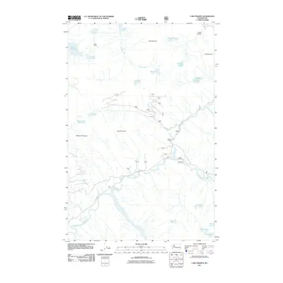
2011 Map of Lake Philippa
USGS Topo · Published 2011About this map
The Middle Fork Snoqualmie River carves through the lower half of this landscape, serving as a primary corridor for a network of forest roads including NFD 5600 RD. This high-elevation terrain is defined by a dense concentration of alpine waters, including Lake Philippa, Marten Lake, and Sunday Lake, many of which are tucked beneath the peaks of Goat Mountain and Bessemer Mountain. In the center of the sheet, the Nordrum Lookout provides a historic vantage point over the drainage basins of Sunday Creek and Hancock Creek. Human activity is concentrated along the river valley at sites like the Taylor River Forest Camp, while the surrounding slopes of Quartz Mountain and Twin Peaks remain largely defined by the natural drainage patterns into Devils Canyon.
Find a feature on this map
30 named features on this map. Tap any name to fly to it.
Don’t see what you’re looking for? This feature index may not catch every label — zoom into the map to look around manually.
Map Details
Editions of this 2011 Lake Philippa Map
This is the sole edition of this map. No revisions or reprints were ever made.
Other maps of this area

1901 · Snoqualmie Pass
USGS Topo · 1:125,000

1902 · Skykomish
USGS Topo · 1:125,000

1903 · Snoqualmie
USGS Topo · 1:125,000

1905 · Skykomish
USGS Topo · 1:125,000

1913 · Cedar Lake
USGS Topo · 1:125,000

1921 · Sultan
USGS Topo · 1:125,000

1923 · Sultan
USGS Topo · 1:125,000

1957 · Wenatchee
USGS Topo · 1:250,000

1960 · Mount Si
USGS Topo · 1:62,500

1960 · Bandera
USGS Topo · 1:62,500