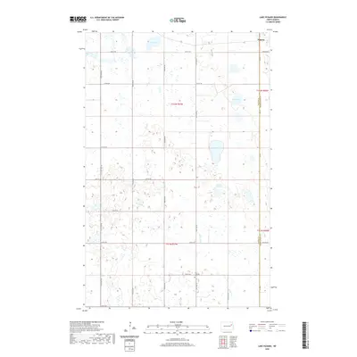
2020 Map of Lake Pickard
USGS Topo · Published 2020About this map
Niagara occupies the northeastern corner of this landscape, situated along the border of Nelson and Grand Forks counties. This region of the North Dakota prairie is defined by its numerous small basins and glacial depressions, including Lake Pickard, Deer Lake, and Gopher Tail Lake. The headwaters of the Goose River wind through the southern and western portions of the quadrangle, carving a subtle path through the section lines. This 2020 survey highlights the enduring rectilinear grid of the Public Land Survey System, with gravel routes like Co Rd 9 and 121st Ave NE framing the agricultural tracts. Near the intersection of 33rd St Ne and 124th Ave Ne, the Lom Lutheran Cem provides a specific point of interest for genealogists and local historians, representing a traditional focal point for the surrounding rural community.
Find a feature on this map
28 named features on this map. Tap any name to fly to it.
Don’t see what you’re looking for? This feature index may not catch every label — zoom into the map to look around manually.
Map Details
Editions of this 2020 Lake Pickard Map
This is the sole edition of this map. No revisions or reprints were ever made.
Other maps of this area

1939 · Niagara
USGS Topo · 1:62,500

1942 · McVille
USGS Topo · 1:62,500

1952 · Grand Forks
USGS Topo · 1:250,000

1952 · Thief River Falls
USGS Topo · 1:250,000

1952 · New Rockford
USGS Topo · 1:250,000

1953 · Devils Lake
USGS Topo · 1:250,000

1956 · New Rockford
USGS Topo · 1:250,000

1956 · Thief River Falls
USGS Topo · 1:250,000

1956 · Devils Lake
USGS Topo · 1:250,000

1956 · Grand Forks
USGS Topo · 1:250,000