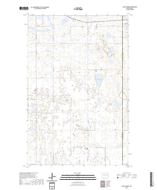
2024 Map of Lake Pickard
USGS Topo · Published 2024About this map
Lom Lutheran Cem sits at a crossroads in the southern portion of this region, serving as a significant landmark for local family historians. The landscape is defined by the prairie pothole region's distinctive hydrology, where numerous unnamed wetlands and larger basins like Lake Pickard, Gopher Tail Lake, and Deer Lake dot the terrain. The Goose River meanders through the central and southern sections, providing a natural drainage system through the undulating plains.
Find a feature on this map
25 named features on this map. Tap any name to fly to it.
Don’t see what you’re looking for? This feature index may not catch every label — zoom into the map to look around manually.
Map Details
Editions of this 2024 Lake Pickard Map
This is the sole edition of this map. No revisions or reprints were ever made.
Other maps of this area

1939 · Niagara
USGS Topo · 1:62,500

1942 · McVille
USGS Topo · 1:62,500

1952 · Grand Forks
USGS Topo · 1:250,000

1952 · Thief River Falls
USGS Topo · 1:250,000

1952 · New Rockford
USGS Topo · 1:250,000

1953 · Devils Lake
USGS Topo · 1:250,000

1956 · New Rockford
USGS Topo · 1:250,000

1956 · Thief River Falls
USGS Topo · 1:250,000

1956 · Devils Lake
USGS Topo · 1:250,000

1956 · Grand Forks
USGS Topo · 1:250,000