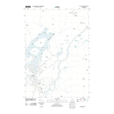
2010 Map of Lake Placid
USGS Topo · Published 2010About this map
The village of Lake Placid serves as the focal point for this mountain landscape, shown just years after the turn of the 21st century. The map illustrates a high density of recreation and local history infrastructure, from the Olympic Arena and Olympic Ski Jumps to the Lake Placid Airport. To the north, the waters of Lake Placid are split by Moose Island and bounded by Whiteface Mountain, while smaller settlements like Undercliff and Whiteface Landing dot the shoreline. The southern reaches of the map highlight historical sites such as the North Elba Cemetery near John Brown Rd, and the winding course of the Chubb River. The terrain is defined by dramatic elevation changes, moving from the lowlands of Mirror Lake up through the Sentinel Range and the high summits of the Adirondack peaks.
Find a feature on this map
84 named features on this map. Tap any name to fly to it.
Don’t see what you’re looking for? This feature index may not catch every label — zoom into the map to look around manually.
Map Details
Editions of this 2010 Lake Placid Map
This is the sole edition of this map. No revisions or reprints were ever made.
Other maps of this area

1895 · Mt. Marcy
USGS Topo · 1:62,500

1896 · Lake Placid
USGS Topo · 1:62,500

1898 · Lake Placid
USGS Topo · 1:62,500

1902 · Mt. Marcy
USGS Topo · 1:62,500

1902 · Saranac
USGS Topo · 1:62,500

1904 · Saranac
USGS Topo · 1:62,500

1904 · Santanoni
USGS Topo · 1:62,500

1948 · Ogdensburg
USGS Topo · 1:250,000

1950 · Lake Champlain
USGS Topo · 1:250,000

1951 · Ogdensburg
USGS Topo · 1:250,000