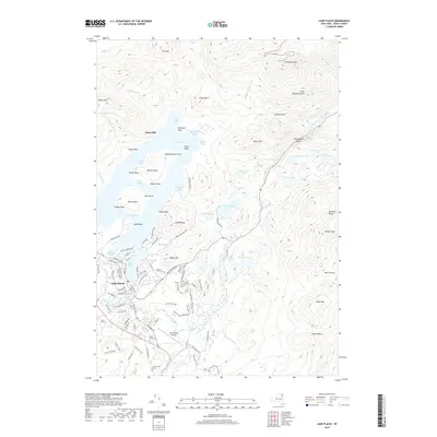
2019 Map of Lake Placid
USGS Topo · Published 2019About this map
Whiteface Mtn and the Sentinel Range dominate this northern landscape, where the High Peaks region of the Adirondack Park meets the resort life of the High Peaks. The village of Lake Placid serves as the focal point, situated between the namesake lake and Mirror Lake. Significant local heritage is preserved at John Browns Grave and the nearby North Elba Cem, marking the area's deep-rooted history long before its fame as a winter sports destination.
Find a feature on this map
127 named features on this map. Tap any name to fly to it.
Don’t see what you’re looking for? This feature index may not catch every label — zoom into the map to look around manually.
Map Details
Editions of this 2019 Lake Placid Map
This is the sole edition of this map. No revisions or reprints were ever made.
Other maps of this area

1895 · Mt. Marcy
USGS Topo · 1:62,500

1896 · Lake Placid
USGS Topo · 1:62,500

1898 · Lake Placid
USGS Topo · 1:62,500

1902 · Mt. Marcy
USGS Topo · 1:62,500

1902 · Saranac
USGS Topo · 1:62,500

1904 · Saranac
USGS Topo · 1:62,500

1904 · Santanoni
USGS Topo · 1:62,500

1948 · Ogdensburg
USGS Topo · 1:250,000

1950 · Lake Champlain
USGS Topo · 1:250,000

1951 · Ogdensburg
USGS Topo · 1:250,000