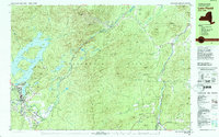
1979 Map of Lake Placid
USGS Topo · Published 1979About this map
John Browns Grave and the surrounding homestead land in North Elba anchor the southern portion of this landscape, just as the 1980 Winter Games were transforming the area. The map documents the local geography of international sports, noting the Olympic Arena, Olympic Ice Sheet, and the 90-meter Tower and 70-meter Tower used for ski jumping. Beyond the village of Lake Placid, the terrain is defined by the Sentinel Range and the West Branch Ausable River, which cuts through the dramatic Wilmington Notch.
Find a feature on this map
103 named features on this map. Tap any name to fly to it.
Don’t see what you’re looking for? This feature index may not catch every label — zoom into the map to look around manually.
Map Details
Editions of this 1979 Lake Placid Map
This is the sole edition of this map. No revisions or reprints were ever made.
Other maps of this area

1894 · Elizabethtown
USGS Topo · 1:62,500

1895 · Elizabethtown
USGS Topo · 1:62,500

1895 · Mt. Marcy
USGS Topo · 1:62,500

1895 · Ausable
USGS Topo · 1:62,500

1896 · Lake Placid
USGS Topo · 1:62,500

1898 · Lake Placid
USGS Topo · 1:62,500

1901 · Elizabethtown
USGS Topo · 1:62,500

1902 · Mt. Marcy
USGS Topo · 1:62,500

1902 · Saranac
USGS Topo · 1:62,500

1903 · Ausable
USGS Topo · 1:62,500