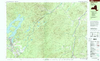
1999 Map of Lake Placid
USGS Topo · Published 2001About this map
The village of Lake Placid serves as the hub of this mountainous landscape within Adirondack Park, where winter sports infrastructure sits alongside significant historical sites. Near the Chubb River, researchers can find the John Brown Farm State Historic Site and the John Brown Grave, marking the final resting place of the noted abolitionist. The built environment reflects the area's legacy as a host for international athletics, featuring the Olympic Arena, Olympic Ice Shed, and the Olympic Ski Jumps with its 90-meter and 70-meter structures. Beyond the village, the terrain is defined by the West Branch Ausable River carving through the Wilmington Range and Sentinel Mountain. The map detail extends to the northern reaches of Whiteface Mountain, including the Whiteface Mountain Ski Center, while capturing local institutions such as the Northwood School and Placid Memorial Hospital.
Find a feature on this map
102 named features on this map. Tap any name to fly to it.
Don’t see what you’re looking for? This feature index may not catch every label — zoom into the map to look around manually.
Map Details
Editions of this 1999 Lake Placid Map
This is the sole edition of this map. No revisions or reprints were ever made.
Other maps of this area

1894 · Elizabethtown
USGS Topo · 1:62,500

1895 · Elizabethtown
USGS Topo · 1:62,500

1895 · Mt. Marcy
USGS Topo · 1:62,500

1895 · Ausable
USGS Topo · 1:62,500

1896 · Lake Placid
USGS Topo · 1:62,500

1898 · Lake Placid
USGS Topo · 1:62,500

1901 · Elizabethtown
USGS Topo · 1:62,500

1902 · Mt. Marcy
USGS Topo · 1:62,500

1902 · Saranac
USGS Topo · 1:62,500

1903 · Ausable
USGS Topo · 1:62,500