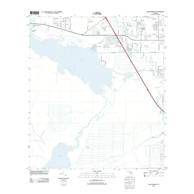
2012 Map of Lake Poinsett
USGS Topo · Published 2012About this map
The Saint Johns River corridor defines this portion of the Florida landscape, winding southward through a chain of major water bodies including Lake Poinsett and Lake Winder. This 2012 survey illustrates the contrast between the sprawling wetlands and the encroaching residential developments of the Cocoa West area. To the north, a dense network of suburban streets such as Borinquen Ave and Satellite Blvd terminates at the water's edge, while smaller landings like Poinsett Lodge and Lane Cabbage Camp provide access to the river system. A notable archaeological and topographic landmark, Mulberry Mound, stands near the river's entry into the lake. Further east, the Pine Crest Cem and a series of smaller lakes like Lake Florence and Barnett Lake sit along the transition from developed residential blocks to the open drainage basins and the Faulk Canal.
Find a feature on this map
87 named features on this map. Tap any name to fly to it.
Don’t see what you’re looking for? This feature index may not catch every label — zoom into the map to look around manually.
Map Details
Editions of this 2012 Lake Poinsett Map
This is the sole edition of this map. No revisions or reprints were ever made.
Other maps of this area

1949 · Courtenay
USGS Topo · 1:24,000

1949 · Eau Gallie
USGS Topo · 1:24,000

1949 · Sharpes
USGS Topo · 1:24,000

1949 · Cocoa
USGS Topo · 1:24,000

1951 · Eau Gallie
USGS Topo · 1:24,000

1951 · Cocoa
USGS Topo · 1:24,000

1951 · Courtenay
USGS Topo · 1:24,000

1951 · Sharpes
USGS Topo · 1:24,000

1953 · Lake Poinsett
USGS Topo · 1:24,000

1953 · Deer Park NE
USGS Topo · 1:24,000