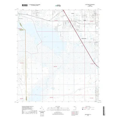
2018 Map of Lake Poinsett
USGS Topo · Published 2018About this map
The Saint Johns River corridor anchors this landscape, widening into the expansive Lake Poinsett and Lake Winder south of the developing outskirts of Cocoa. This 2018 survey reveals the distinct boundary between the low-lying wetlands of the river basin and the growing suburban grid of Cocoa West and Rockledge to the east. Within the residential blocks, the Pine Crest Cem and various local thoroughfares like King St and Dixon Blvd mark the encroachment of the Space Coast's urban footprint toward the river's edge.
Find a feature on this map
75 named features on this map. Tap any name to fly to it.
Don’t see what you’re looking for? This feature index may not catch every label — zoom into the map to look around manually.
Map Details
Editions of this 2018 Lake Poinsett Map
This is the sole edition of this map. No revisions or reprints were ever made.
Other maps of this area

1949 · Courtenay
USGS Topo · 1:24,000

1949 · Eau Gallie
USGS Topo · 1:24,000

1949 · Sharpes
USGS Topo · 1:24,000

1949 · Cocoa
USGS Topo · 1:24,000

1951 · Eau Gallie
USGS Topo · 1:24,000

1951 · Cocoa
USGS Topo · 1:24,000

1951 · Courtenay
USGS Topo · 1:24,000

1951 · Sharpes
USGS Topo · 1:24,000

1953 · Lake Poinsett
USGS Topo · 1:24,000

1953 · Deer Park NE
USGS Topo · 1:24,000