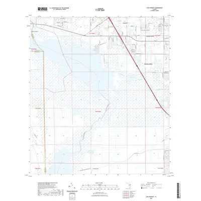
2021 Map of Lake Poinsett
USGS Topo · Published 2021About this map
Lake Poinsett and the sprawling wetlands of the St. Johns River basin dominate this 2021 landscape, illustrating the delicate balance between Florida's central wilderness and the expanding suburban reaches of Brevard County. To the northeast, the communities of Cocoa West and Rockledge show a dense modern street grid, while the western and southern portions of the map remain largely defined by water and conservation lands. Notable landmarks include the Pine Crest Cem and Mulberry Mound, the latter providing a historical topographical anchor amidst the marshes. The map traces recreational and environmental corridors like the St Johns River Blueway Trl and the River Lakes Conservation Area Trl, which meander toward Lake Winder. This survey captures the region's hydrography in detail, including Rockledge Cr, Barnett Lake, and the engineered Faulk Canal.
Find a feature on this map
56 named features on this map. Tap any name to fly to it.
Don’t see what you’re looking for? This feature index may not catch every label — zoom into the map to look around manually.
Map Details
Editions of this 2021 Lake Poinsett Map
This is the sole edition of this map. No revisions or reprints were ever made.
Other maps of this area

1949 · Courtenay
USGS Topo · 1:24,000

1949 · Eau Gallie
USGS Topo · 1:24,000

1949 · Sharpes
USGS Topo · 1:24,000

1949 · Cocoa
USGS Topo · 1:24,000

1951 · Eau Gallie
USGS Topo · 1:24,000

1951 · Cocoa
USGS Topo · 1:24,000

1951 · Courtenay
USGS Topo · 1:24,000

1951 · Sharpes
USGS Topo · 1:24,000

1953 · Lake Poinsett
USGS Topo · 1:24,000

1953 · Deer Park NE
USGS Topo · 1:24,000