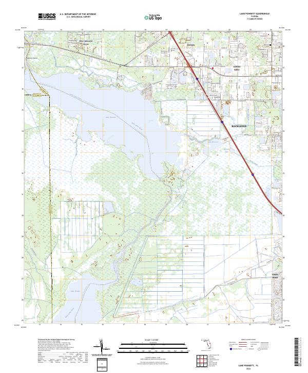
2024 Map of Lake Poinsett
USGS Topo · Published 2024About this map
Lake Poinsett and the winding Saint Johns River dominate this Central Florida landscape, where the marshy river basin meets the expanding residential footprints of Rockledge and Cocoa West. The map documents a complex aquatic network including Lake Winder to the south and the Faulk Canal, illustrating the historical and modern efforts to manage the wetlands of the St. Johns River Valley. On the eastern edge, suburban development is dense along corridors like Dixon Blvd and King St, while the western portion remains largely defined by the River Lakes Conservation Area Trl. Notable landmarks such as Mulberry Mound and the Pinecrest Cem provide specific points of interest for local historians, marking the intersection of early topographical features and community institutions within the larger West Canaveral Groves area.
Find a feature on this map
90 named features on this map. Tap any name to fly to it.
Don’t see what you’re looking for? This feature index may not catch every label — zoom into the map to look around manually.
Map Details
Editions of this 2024 Lake Poinsett Map
This is the sole edition of this map. No revisions or reprints were ever made.
Other maps of this area

1949 · Courtenay
USGS Topo · 1:24,000

1949 · Eau Gallie
USGS Topo · 1:24,000

1949 · Sharpes
USGS Topo · 1:24,000

1949 · Cocoa
USGS Topo · 1:24,000

1951 · Eau Gallie
USGS Topo · 1:24,000

1951 · Cocoa
USGS Topo · 1:24,000

1951 · Courtenay
USGS Topo · 1:24,000

1951 · Sharpes
USGS Topo · 1:24,000

1953 · Lake Poinsett
USGS Topo · 1:24,000

1953 · Deer Park NE
USGS Topo · 1:24,000