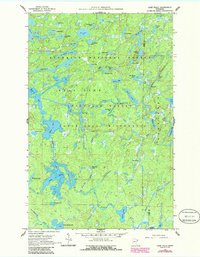
1960 Map of Lake Polly
USGS Topo · Published 1986About this map
The Boundary Waters Canoe Area Wilderness dominates this landscape, showing a complex network of glacial lakes and waterways within the Superior National Forest as they appeared in 1960. The hydrography is particularly dense, with the Kawishiwi River winding through the terrain, connecting water bodies like Kivaniva Lake and Shoveller Lake. The map serves as a detailed record of this protected wilderness area before later recreational shifts, capturing the exact positions of numerous small, distinctively named lakes such as Humpback Lake and Whopper Lake.
Find a feature on this map
55 named features on this map. Tap any name to fly to it.
Don’t see what you’re looking for? This feature index may not catch every label — zoom into the map to look around manually.
Map Details
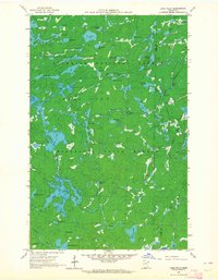
Editions of this 1960 Lake Polly Map
4 editions found
Other maps of this area

1954 · Two Harbors
USGS Topo · 1:250,000

1957 · Two Harbors
USGS Topo · 1:250,000

1957 · Quetico
USGS Topo · 1:250,000

1958 · Two Harbors
USGS Topo · 1:250,000

1959 · Ogishkemuncie Lake
USGS Topo · 1:24,000

1959 · Kekekabic Lake
USGS Topo · 1:24,000

1959 · Gillis Lake
USGS Topo · 1:24,000

1960 · Lake Polly
USGS Topo · 1:24,000

1960 · Kawishiwi Lake
USGS Topo · 1:24,000

1960 · Perent Lake
USGS Topo · 1:24,000