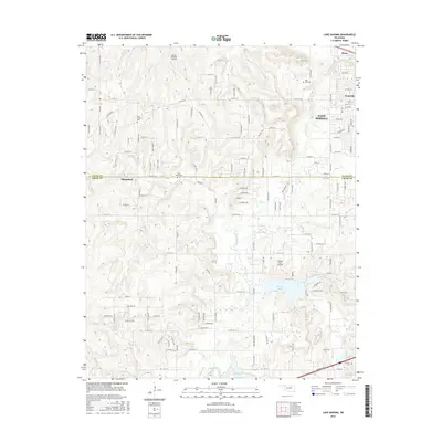
2016 Map of Lake Sahoma
USGS Topo · Published 2016About this map
Sahoma Lake and Pretty Water Lake serve as the central landmarks of this Creek County landscape, where the rural character of the region meets the expanding outskirts of Sand Springs and Prattville. The map captures a detailed network of section-line roads and named avenues, such as Angus Dr and Overcrest Ln, which indicate residential development threading through the hills. This 2016 survey is particularly valuable for genealogical research, documenting several distinct burial grounds including Tiger Bone Cem, Rock Creek Cem, and Oak Cem. Aviation history is also present, with both the Sahoma Lake Airport and the Flying G Ranch Airport marked. Small settlements like Shirk appear alongside significant water features like Euchee Cr and the Sapulpa Reservoir, illustrating the geographic relationship between local watersheds and the regional transportation grid.
Find a feature on this map
122 named features on this map. Tap any name to fly to it.
Don’t see what you’re looking for? This feature index may not catch every label — zoom into the map to look around manually.
Map Details
Editions of this 2016 Lake Sahoma Map
This is the sole edition of this map. No revisions or reprints were ever made.
Other maps of this area

1901 · Nuyaka
USGS Topo · 1:125,000

1912 · Hominy
USGS Topo · 1:125,000

1914 · Kiefer
USGS Topo · 1:62,500

1915 · Hominy
USGS Topo · 1:125,000

1916 · Kiefer
USGS Topo · 1:62,500

1916 · Bristow
USGS Topo · 1:62,500

1954 · Oklahoma City
USGS Topo · 1:250,000

1955 · Enid
USGS Topo · 1:250,000

1956 · Sand Springs
USGS Topo · 1:24,000

1956 · Sapulpa North
USGS Topo · 1:24,000