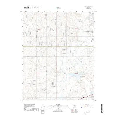
2018 Map of Lake Sahoma
USGS Topo · Published 2018About this map
Lake Sahoma and the adjacent Pretty Water Lake anchor this 2018 survey of the hills west of Sapulpa, where the border of Tulsa and Creek Counties meets. The landscape is defined by a dense network of suburban and rural roads, including residential developments near Prattville and the eastern edge of Mannford. This modern topographical study provides essential data for local historians tracing land use near traditional burial sites such as Tiger Bone Cem, Rock Creek Cem, and Post Oak Cem. Along the northern edge of the map, the Flying G Ranch Airport stands as a notable landmark near Sand Springs, while various drainage systems like Rock Creek and Euchee Creek carve through the terrain. The presence of several unnamed reservoirs, such as 037065 Reservoir, indicates the ongoing importance of water management in this part of Oklahoma.
Find a feature on this map
68 named features on this map. Tap any name to fly to it.
Don’t see what you’re looking for? This feature index may not catch every label — zoom into the map to look around manually.
Map Details
Editions of this 2018 Lake Sahoma Map
This is the sole edition of this map. No revisions or reprints were ever made.
Other maps of this area

1901 · Nuyaka
USGS Topo · 1:125,000

1912 · Hominy
USGS Topo · 1:125,000

1914 · Kiefer
USGS Topo · 1:62,500

1915 · Hominy
USGS Topo · 1:125,000

1916 · Kiefer
USGS Topo · 1:62,500

1916 · Bristow
USGS Topo · 1:62,500

1954 · Oklahoma City
USGS Topo · 1:250,000

1955 · Enid
USGS Topo · 1:250,000

1956 · Sand Springs
USGS Topo · 1:24,000

1956 · Sapulpa North
USGS Topo · 1:24,000