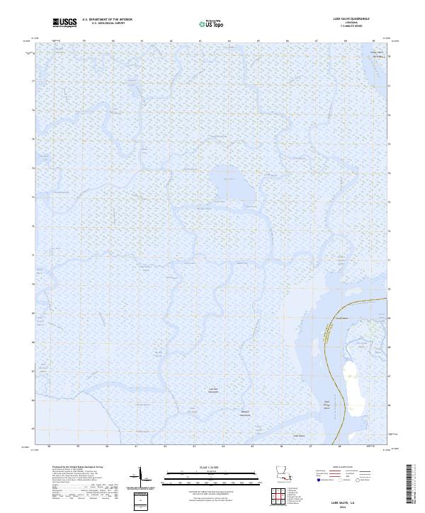
2024 Map of Lake Salve
USGS Topo · Published 2024About this map
Lake Salve lies at the center of this intricate coastal drainage network where the Lower Atchafalaya River meets the labyrinthine bayous of St. Mary Parish. The landscape is defined by the constant movement of water through channels like Big Wax Bayou, Cypress Pass, and Upper Pass. These waterways isolate distinctive landforms such as Avoca Island and Cutoff Island, which emerge from the surrounding wetlands.
Find a feature on this map
57 named features on this map. Tap any name to fly to it.
Don’t see what you’re looking for? This feature index may not catch every label — zoom into the map to look around manually.
Map Details
Editions of this 2024 Lake Salve Map
This is the sole edition of this map. No revisions or reprints were ever made.
Other maps of this area

1932 · Lake Decade
USGS Topo · 1:62,500

1935 · Belle Isle
USGS Topo · 1:31,680

1935 · Morgan City
USGS Topo · 1:62,500

1941 · Belle Isle
USGS Topo · 1:62,500

1945 · New Orleans
USGS Topo · 1:250,000

1954 · Morgan City
USGS Topo · 1:62,500

1954 · Belle Isle
USGS Topo · 1:62,500

1957 · Lake Decade
USGS Topo · 1:62,500

1957 · Point Au Fer
USGS Topo · 1:62,500

1963 · New Orleans
USGS Topo · 1:250,000